| Back to Article | DA-02 | DA-03 | DA-04 | DA-06 | DA-11 | View all 5 fires |
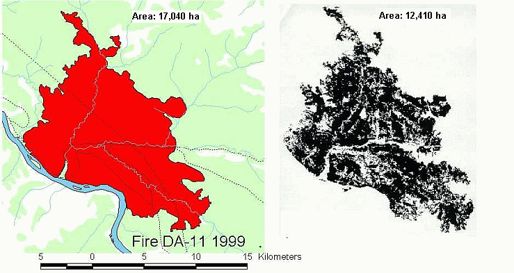
| Fire DA-11 1999 | Perimeter Mapping vs. Satellite Mapping |
|
|
| In the example above, the left-hand image shows the results of the perimeter mapping method used to calculate the area of each fire. The right-hand image shows the actual area burned as determined from Landsat imagery. The black "pixels" represent burned areas. | |